Barrett Lane Drainage and Sidewalk Improvement
Map anchor: Barrett Lane & Fairhaven AvenueProject area: Along Circula Panorama, Fairhaven Extension and Barrett Lane
Illustrative sponsorship$95,000
View intersection on Google Maps ↗Stronger neighborhoods. Safer streets.
A new way for local businesses to support safer sidewalks, better bikeways, and stronger communities through visible public infrastructure investment.
How it works
Discover public infrastructure projects and illustrative sponsorship concepts in your community.
Tell us which projects interest you. Our team can discuss the concept and next steps.
Potential sponsorship recognition may be designed in coordination with participating public agencies, subject to approval.
Sponsor recognition
Examples of how sponsorship recognition could appear during construction and after a project is completed. The organizations and amounts pictured are illustrative only.
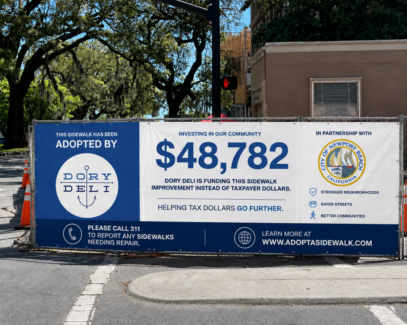
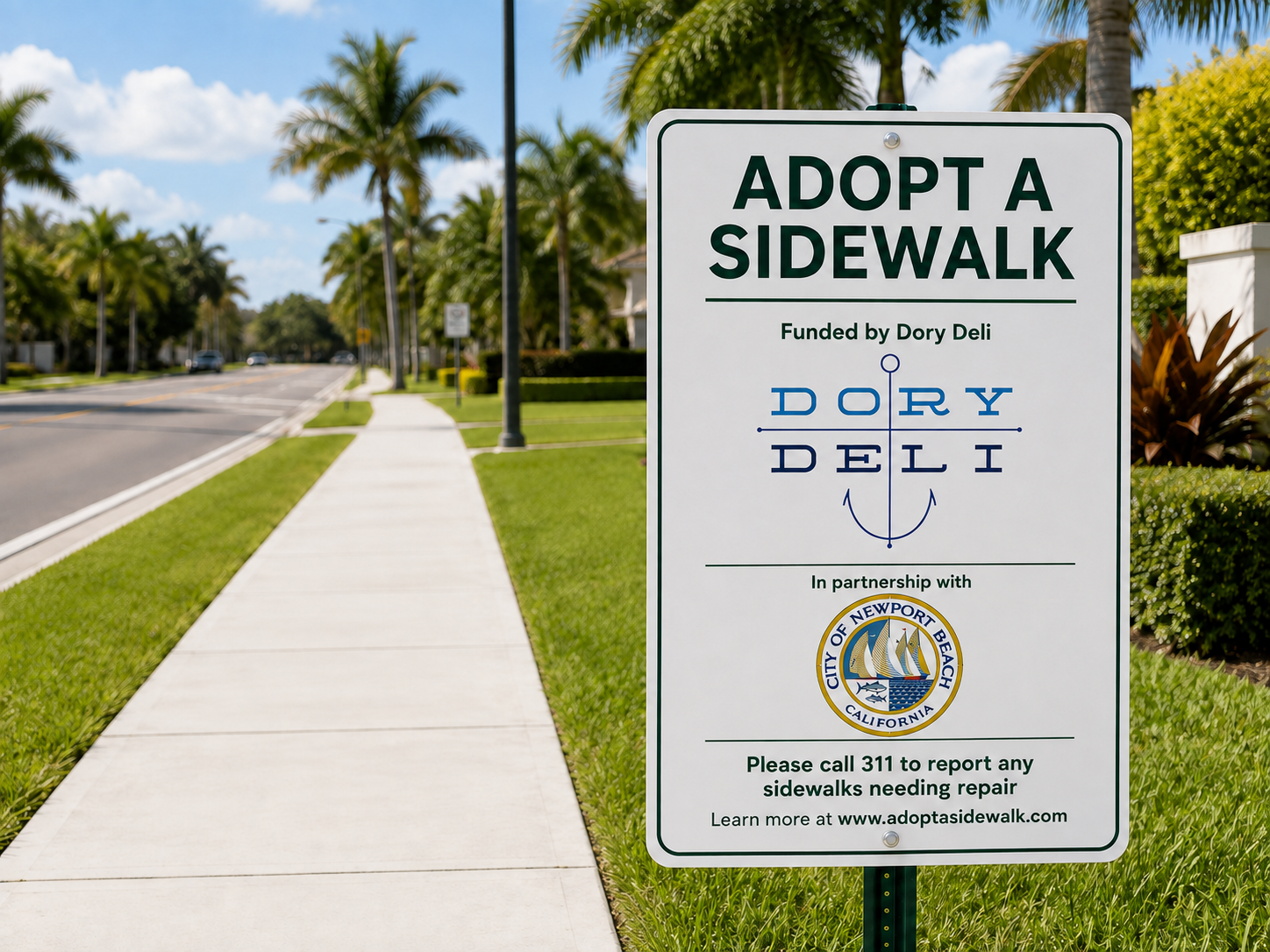
Orange County · 2026–2033
Browse sidewalk, accessibility, and bikeway project concepts across Orange County. Select any project to highlight its approximate location. Sponsorship amounts are illustrative examples, not official project budgets.
Map anchor: Barrett Lane & Fairhaven AvenueProject area: Along Circula Panorama, Fairhaven Extension and Barrett Lane
Map anchor: Browning Avenue & Rainbow DriveProject area: Along Browning Avenue, from Rainbow Drive to Beverly Glen Drive, within the
Map anchor: Crawford Canyon Road & Newport AvenueProject area: Crawford Canyon Road (eastside) from Newport Avenue to Stoller Lane.
Map anchor: El Modena neighborhood, Orange, CAProject area: Along various streets in unincorporated county island of El Modena.
Map anchor: Prospect Avenue & Santa Clara AvenueProject area: Rainer Drive to Santa Clara Street along Prospect Avenue.
Map anchor: Rossmoor, CAProject area: Along various streets in unincorporated county island of Rossmoor.
Map anchor: Santa Clara Avenue & Yorba StreetProject area: Along Santa Clara Avenue and Yorba Street within North Tustin.
Map anchor: Villa Park Road & Lemon StreetProject area: Villa Park Road from Lemon Street to 650-feet east of Hewes Street, and
Map anchor: Skyline Drive, North Tustin, CAProject area: Along various reaches of Skyline Drive within unincorporated county island of Project Support 100,000…
Map anchor: Coyote Creek Bikeway & La Mirada BoulevardProject area: From North Fork Trail to La Mirada Boulevard
Map anchor: Mesa Drive & Santa Ana AvenueProject area: Along Mesa Drive, Santa Ana Avenue, University Drive and Irvine Avenue
The street map needs an internet connection. Project intersections and Google Maps links are available in the list.
Interactive regional map showing Southern California streets, city names and project-area pins. Pins are approximate anchors based on the listed intersections; use the Google Maps links for street-level verification.
Projects for illustrative purposes only.
Get in touch
Interested in sponsoring a project or discussing a public-sector partnership? Send us a message and we'll be in touch.